After attending a CQB Entry/Breaching class with Eric Pfleger in Montana, I went on a six-day backpack with my parents along the Continental Divide Trail in the Bob Marshall Wilderness. We’d done a similar CDT hike after another of Eric’s classes back in 2016 after another class with Eric down in the Anaconda-Pintler Wilderness.
This time our trip would be to the Chinese Wall, a twelve-mile long cliff face along the Continental Divide.
Gear
This would be my first hike with my new Mystery Ranch Blackjack 80 pack. I bought this after Eric’s Longrifle/Rural Scout Sniper class back in May to give me a more conventional large Multicam pack than my Eberlestock Skycrane. I thought a six-day backpack would be a pretty good opportunity to wring it out. I’d been putting some time in with it all summer (loading it up and walking up and down the stairs at my apartment complex, since there are no mountains in Kansas).
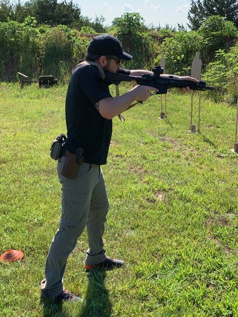
My usual tent, sleeping bag, Thermarest mattress, and some clothes filled about 3/4 of it, leaving the last quarter for food. I also carried a can of bear spray and a 10mm Glock for any encounters with four-legged predators. My parents provided the food and a trekking pole (for which I would be very grateful later in the hike).
Day 0
My parents picked me up from Eric’s place, and we headed over to the east side of the Bob Marshall Wilderness via US 2 (just south of Glacier National Park). We stayed the night at Benchmark Campground near the trailhead.
Day 1
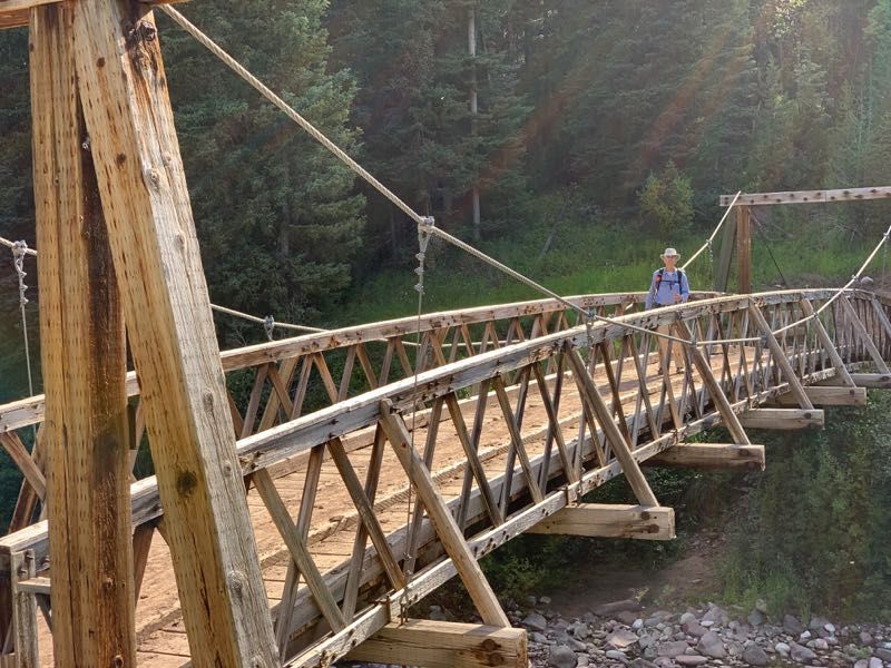
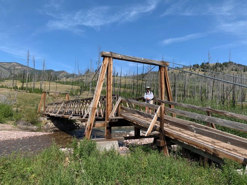
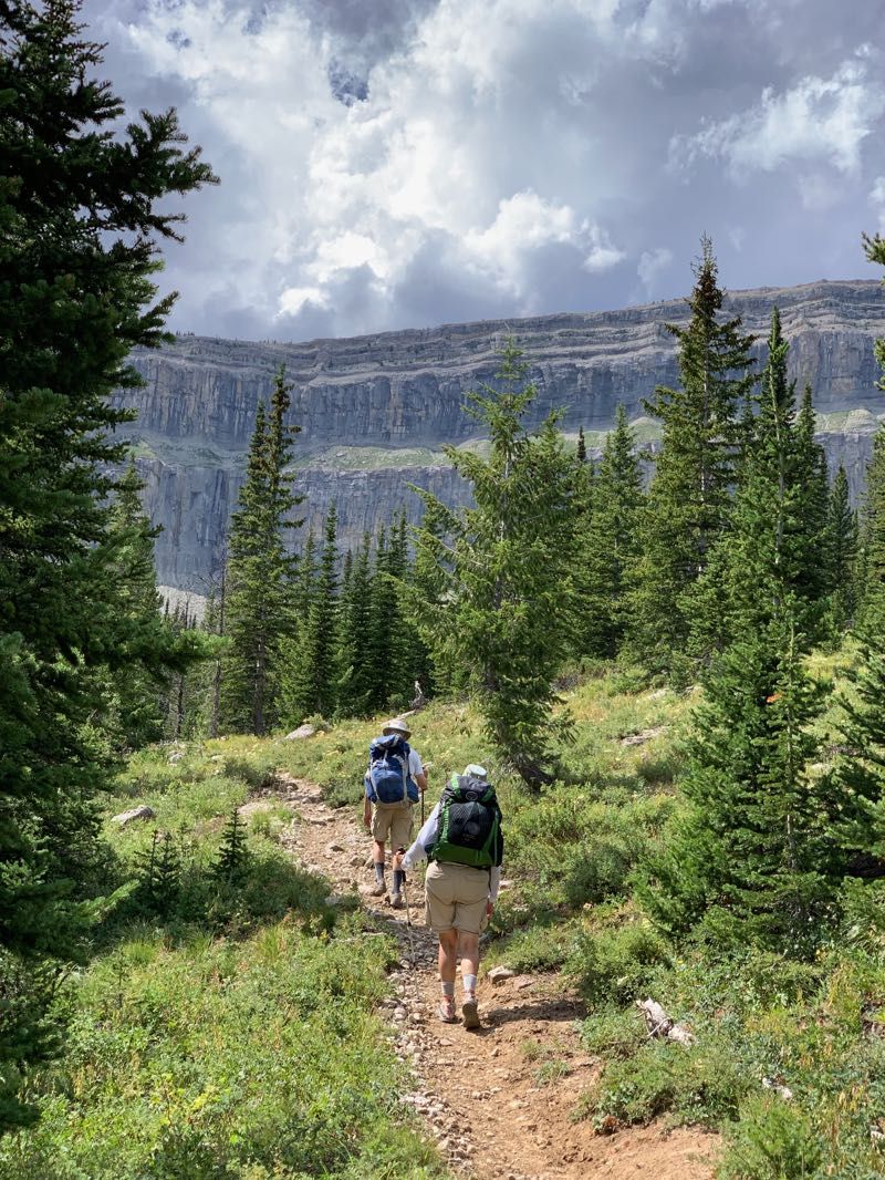
We got all packed up and headed out at 9:30. There was a nice suspension bridge over the South Fork of the Sun River. The trail was broad and not too steep, but there were lots of places where it had been churned up into big mud pits by horses’ hooves. We had to skirt around the edges of these to stay on solid ground.
Along the way, we met a volunteer who staffed one of the forest service patrol cabins out for a day hike. During our conversation, she pitched us very strongly on a side hike up to the top of Prairie Reef. It provides excellent views of the Wall but requires a nine-mile round trip and a 3500-foot climb.
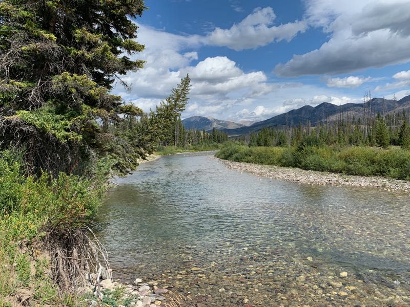
After about four miles we came to another suspension bridge, this one over the West Fork of the South Fork of the Sun River (not confusing at all, is it?). From here we followed the West Fork, gradually climbing upward.
It got pretty warm in the afternoon camping, and we were walking through some burned areas without much shade. We had a nice conversation with the volunteer at the Indian Point patrol cabin. He recommended a good campsite near Indian Creek, about a mile down the trail.
On the way to the campsite, we met a pair of Continental Divide Trail through hikers, heading north to Canada. We talked with them a bit as they took a break. They’re on the leading edge of this year’s northbound CDT hikers (they know of three through hikers ahead of them).
Day 2
The grade on the first day had been relatively gentle, but today found us climbing steadily throughout the day. We had about 2000 feet of elevation to gain before the day was out. During the morning we followed the West Fork of the South Fork of the Sun River and the climb was relatively gradual.
Early in the day, we were moving through mostly newer forest, but as we climbed, we moved into old-growth that had not burned recently. The trail was heavily shaded, nice and cool. There were a fair number of huckleberry bushes along the side of the trail. A horse train with ten guests and two guides passed by us.
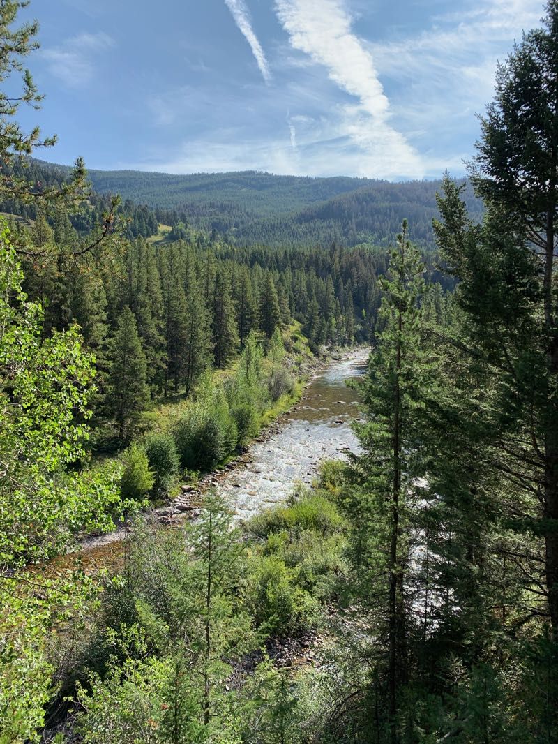
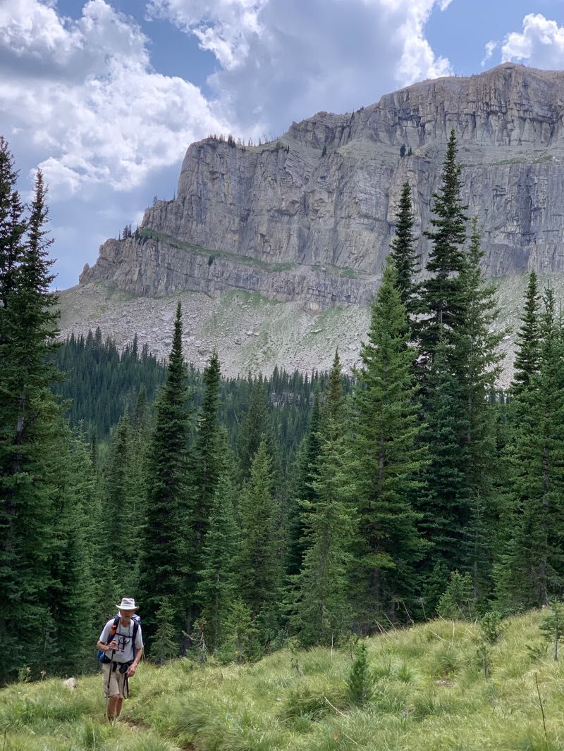
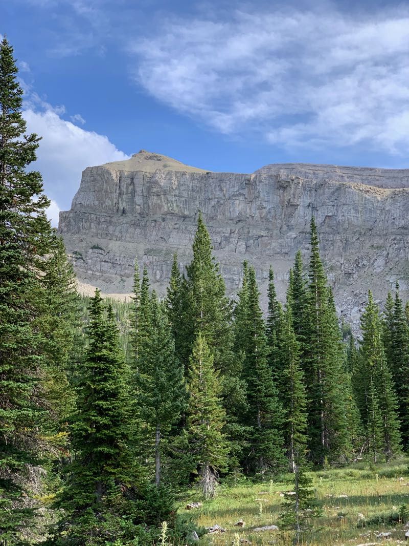
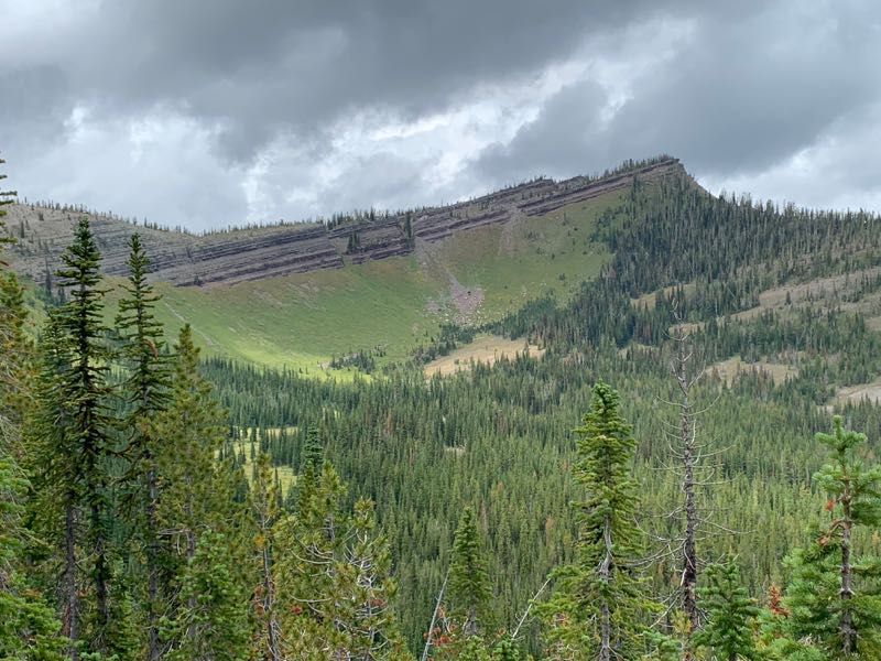
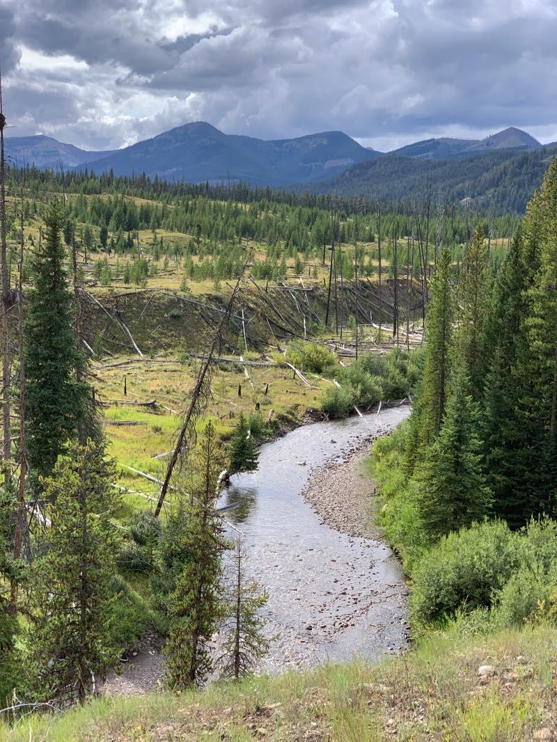
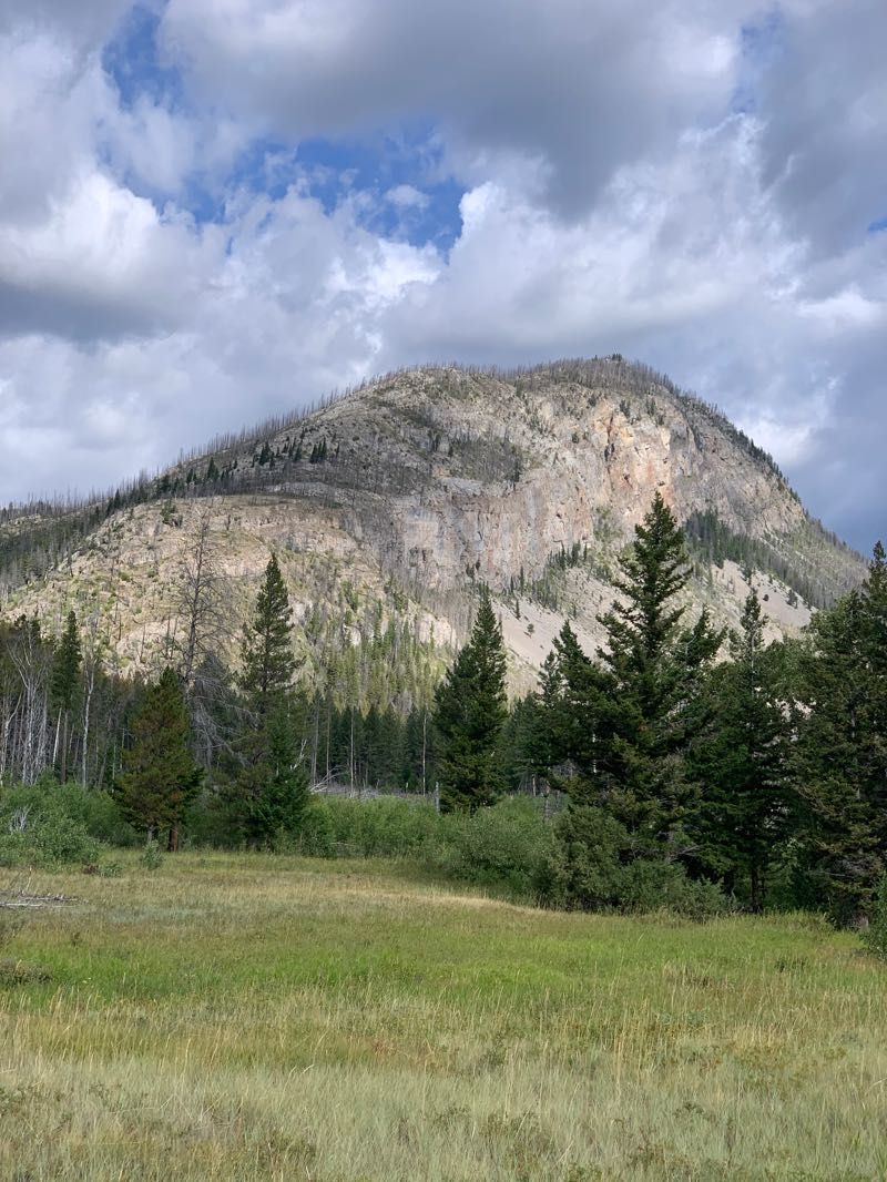
In the early afternoon, we turned west, following Burnt Creek up towards the Chinese Wall. The trail steepened quite a bit, and we lost the protective forest canopy, but some clouds rolling in from the west kept it from getting too hot. As we climbed the Burnt Creek drainage, we got our first view of the Wall around Cliff Mountain.
The trail ascended the north side of the canyon, climbing above Burnt Creek. We heard an elk bugle down towards the creek (that or someone with an elk call). As we got closer to the Wall, we came to an area where the trail had been realigned to reduce the grade, which was quite welcome. We had about 1000 feet of elevation gain in just two miles.
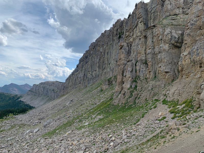
Finally, we topped out at the saddle between Burnt Creek and Moose Creek. Here we caught up with the horse train from earlier. They pointed us up a short side trail that climbed to the base of the Wall and provided great views to the north and south.
We came down from the lookout just as the horse train was leaving, followed quickly by their baggage train of 15 mules and three wranglers (that’s one mule worth of baggage per person!). At this point, it was about 4 o’clock. The saddle marked the beginning of a no-camping zone between Cliff Mountain and Salt Mountain, so going further would commit us to continuing on for several more miles.
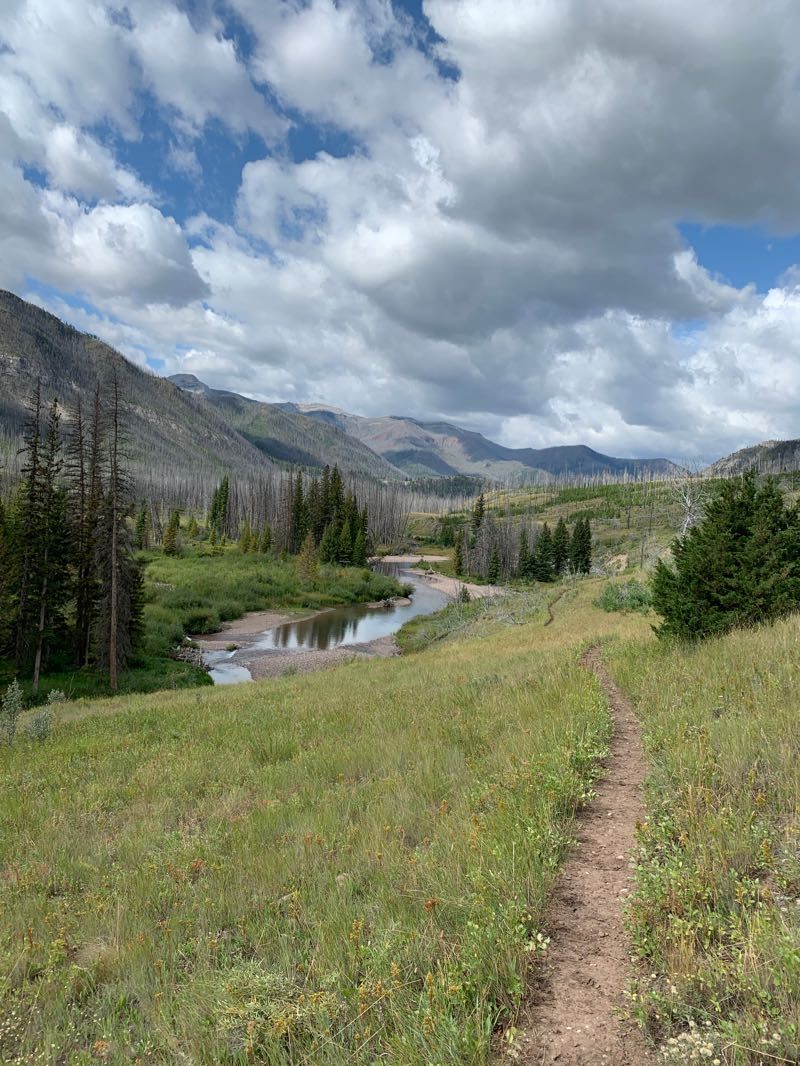
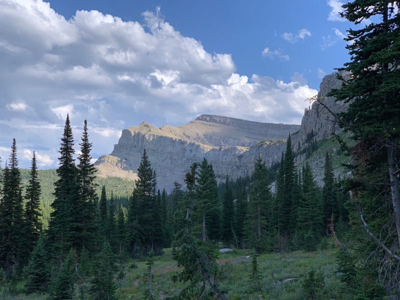
We pushed onward and traversed the upper reaches of Moose Creek, stopping to snap pictures of the Wall as breaks in the clouds delivered good light. Thankfully, the trail kept us near the Wall, and we didn’t drop much elevation; so we didn’t have to gain much to get over the saddle at the base of Salt Mountain that would take us from the Moose Creek drainage to Rock Creek.
We dropped down to Rock Creek and found a nice campsite where the trail crossed the creek. By this time it was about 7 o’clock, making for a very long day. We got the tents up and made a quick dinner so we could turn in as soon as we could. Not long after, we heard the pitter-patter of raindrops on our tents. The rain continued off and on throughout the night, punctuated by thunder echoing off the Chinese Wall.
Day 3
The next day dawned damp and solidly overcast. There was a brief moment of morning light on the Chinese Wall as the rising sun slipped some light underneath the clouds, but it disappeared before I could even get a picture.
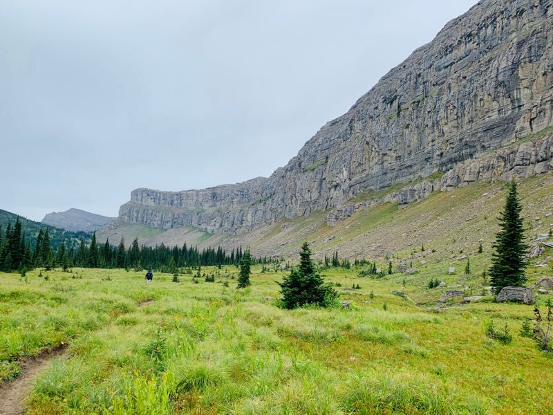
Again, the trail closely hugged the Wall as we walked north through the headwaters of the Rock Creek drainage. The trail had many nice views of the Wall, though in this case they were tempered by the flat light of the overcast sky. It drizzled on and off as we walked, pausing just long enough to tempt us to take off our rain gear before starting up again.
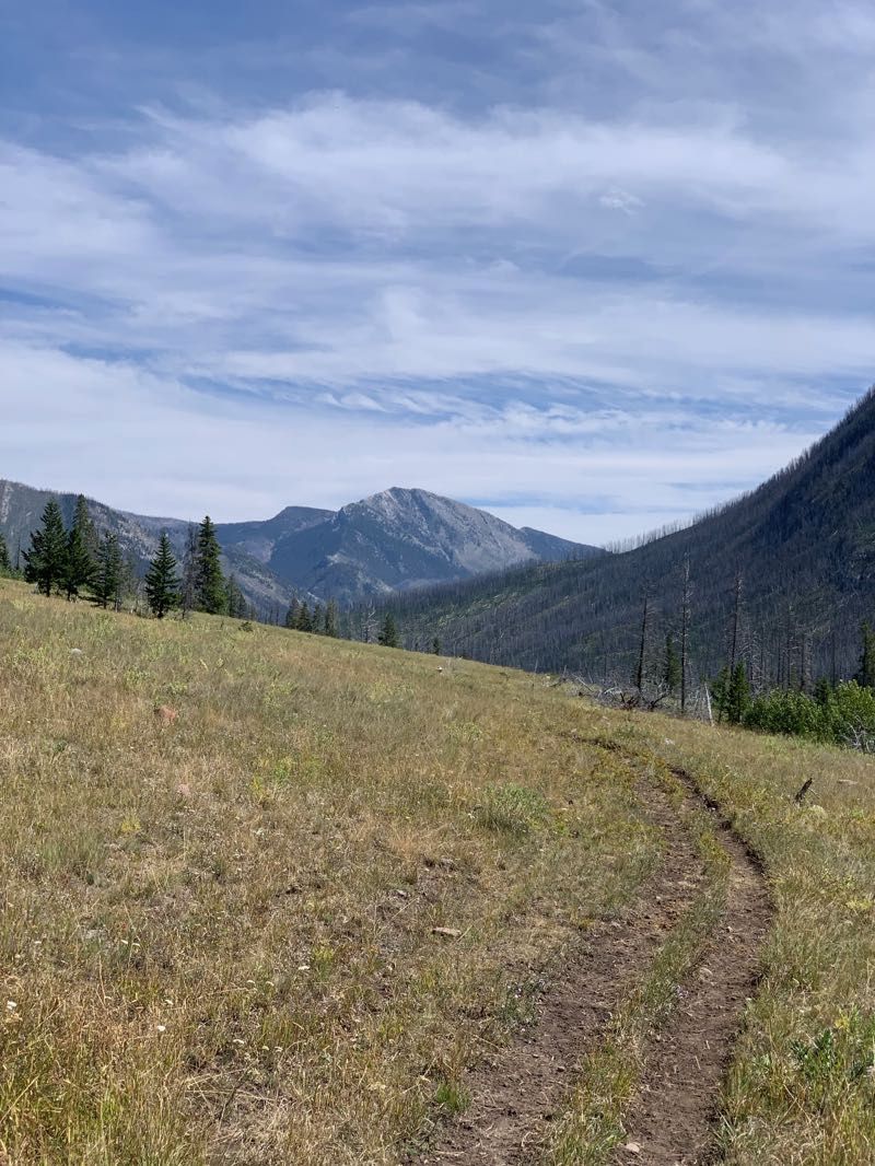
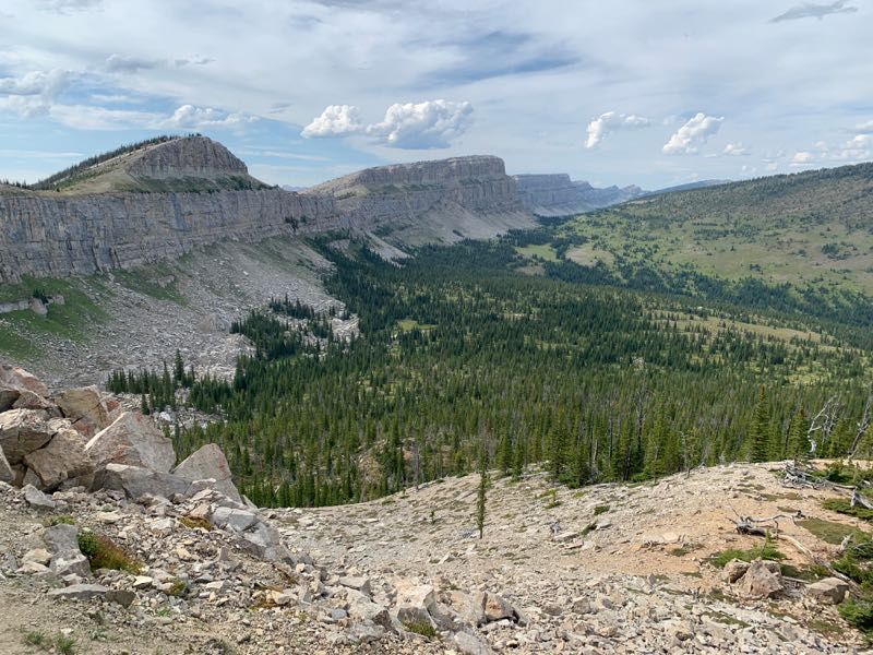
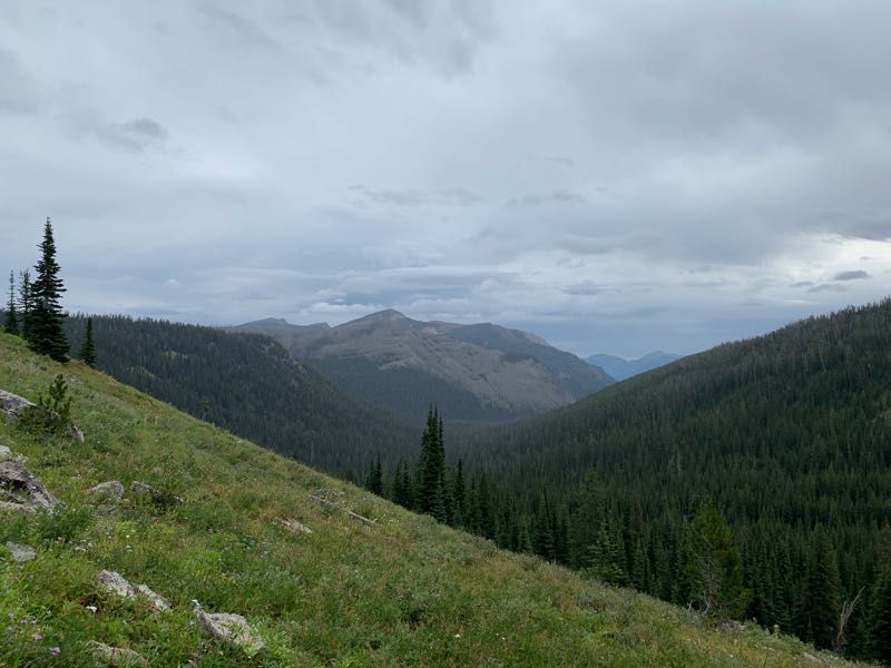
We left the Wall at the north end, swinging around to the east side of Larch Hill. Rounding the hill, we found a spot where we could take a few steps to the top of the ridge for some great views to the north, showing the terrain between here and Maris Pass.
The trail descended steeply down the ridge to Spotted Bear Pass. From here, we would continue to follow the Continental Divide Trail to the east. Most CDT through hikers take an alternate route to the north that cuts off about 17 miles of travel. As it happens, we met another through hiker at the pass. As one might expect, she was planning to take the alternate.
We headed down the trail towards Rock Creek. The forest here was very thick old growth. The damp weather made it feel almost like the Pacific Northwest. Our progress was impeded by the number of huckleberry bushes along the trail; eventually, we had to stop pausing to gobble down every huckleberry we saw.
As we stopped for a break, I noticed a glass insulator attached to some wire, similar to what you might see on an old telephone/telegraph or power line. We wondered what it was doing in such a remote spot.
We came to a patrol cabin (this one unmanned), and half a mile beyond we found a level spot off the trail to set up camp. While today wasn’t quite as long a day as yesterday, we were still ready to crash right after a quick dinner. Again, we got a fair bit of rain overnight.
Day 4
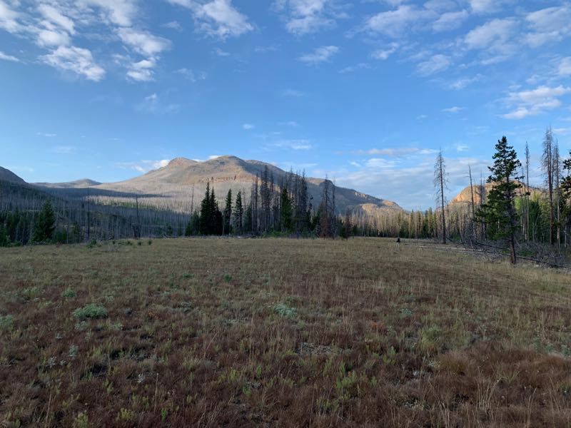
It was cool and overcast again this morning. The clouds were low enough that the upper reaches of the canyon were shrouded in mist. If we were up at the Wall today, we’d likely be walking in the fog.
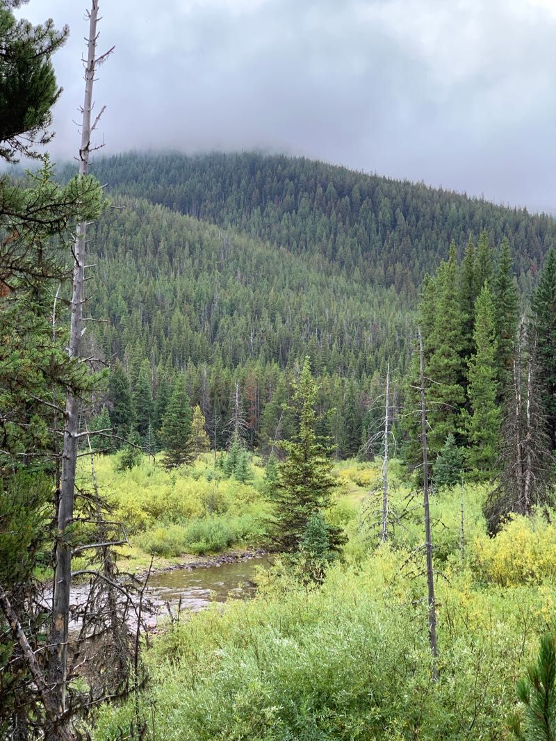
Since there was no water source near our campsite, we walked to the next stream before cooking breakfast. This was more old-growth forest, with a temperate rainforest vibe. We saw a hare or a big rabbit crossing the trail as we walked.
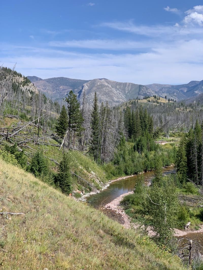
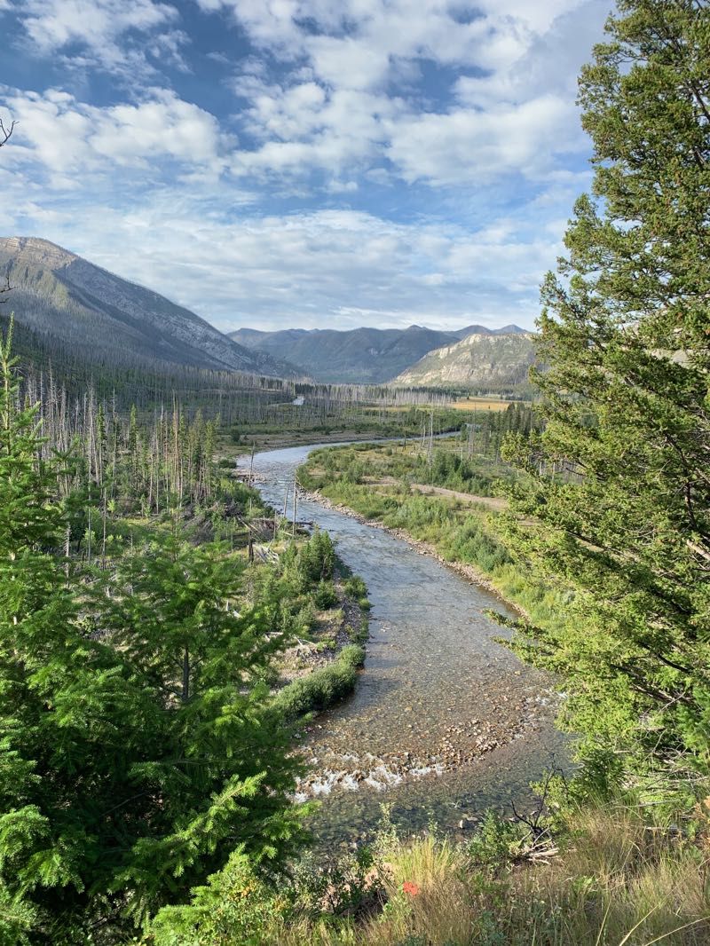
After following Rock Creek in a gradual descent, we climbed out of the Rock Creek drainage over a saddle past Miner’s Creek and Hoxsey Creek, eventually following the latter down to Red Shale Creek.
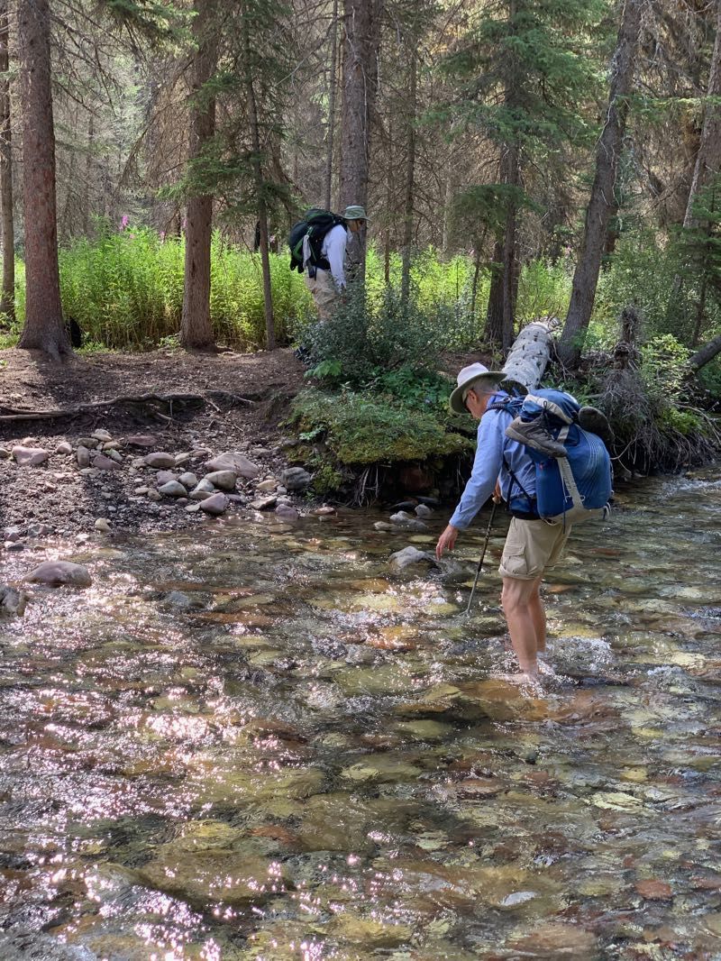
Here we faced a bit of a challenge. All of the previous watercourses we’d crossed had either had bridges (up to and including the very substantial suspension bridges over the forks of the Sun River) or were small enough that we could rock hop across them. In many of those cases, we were near these watercourse’s headwaters up near the Wall. Now we were much further from the Wall, and Red Shale Creek had the benefit of a much larger watershed (and quite a bit of rain in the past few days). It was much too deep to rock hop across. I ended up stripping off my boots and socks and fording the creek barefoot.
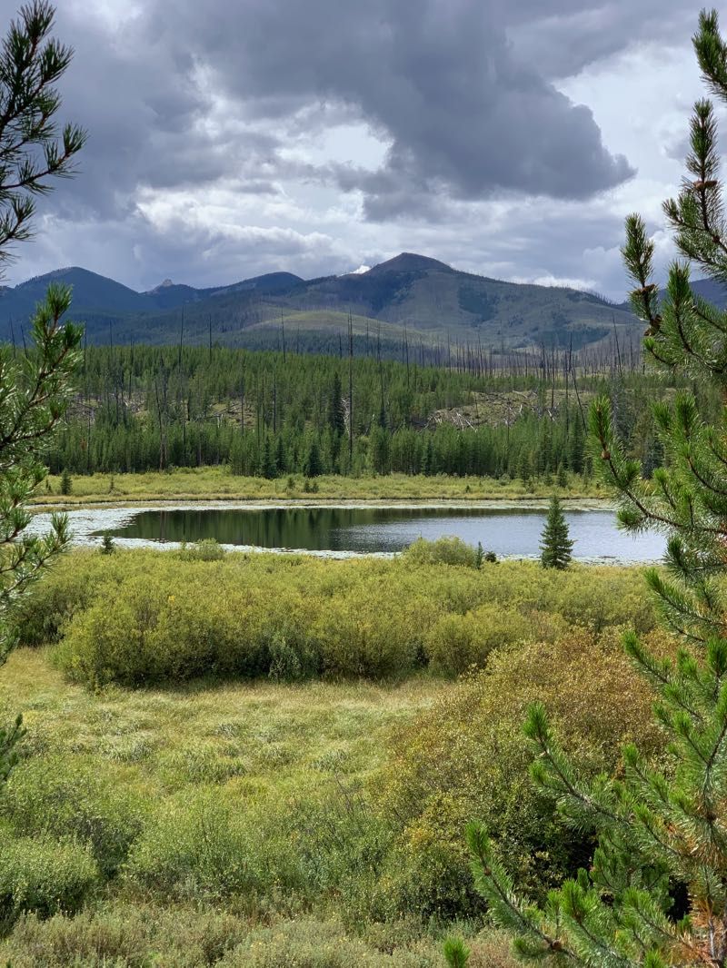
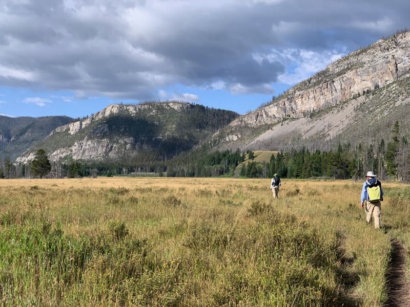
We continued to Gates Park, site of a rough field airstrip, where we finally left the Continental Divide Trail. Around this time the overcast broke up, clearing to partly cloudy skies. From here, our route grew much less traveled and more faint. After a bit of trouble, we were able to find the path south. We scared up a pair of cranes near Gates Lake, which cackled at us as they flew off majestically.
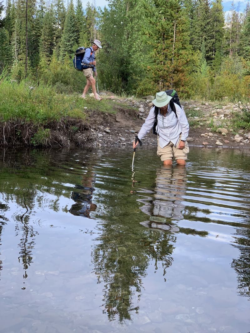
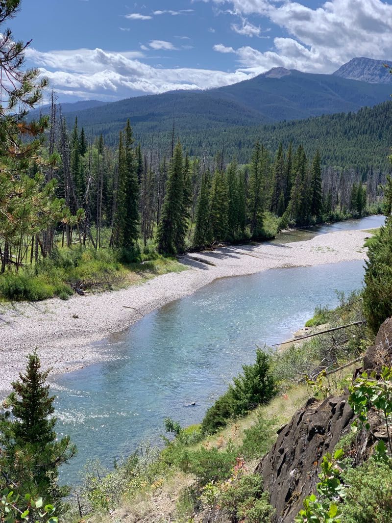
After a few miles, we dropped down to the North Fork of the Sun River. There we found ourselves back at Rock Creek, a few miles downstream from where we’d left it. Now it was a far more substantial watercourse than the one we’d been able to hop across in a single bound up near the Chinese Wall. Once again, I took off my boots and socks and forded barefoot. We continued south a bit and camped atop a hill. The area was thick with old elk droppings (I also saw a bit of old bear scat there as well, though I didn’t mention this to my parents). It was also thick with mosquitos, so we ate a hasty dinner and dove into our tents early.
Day 5
After the coldest night so far this trip, the day began with a thick overcast. We bundled up and headed south again. After a mile or so we were presented with a dilemma: a shorter route that would require fording the North Fork of the Sun River twice, or a route 1.2 miles longer that would keep us on this side of the river. We chose the longer route. We did not escape fording entirely, however, as we had to cross Moose Creek. Much like Rock Creek, this had grown from a small stream up near the Wall to a much more substantial waterway. Again, I stripped off socks and boots walk across.
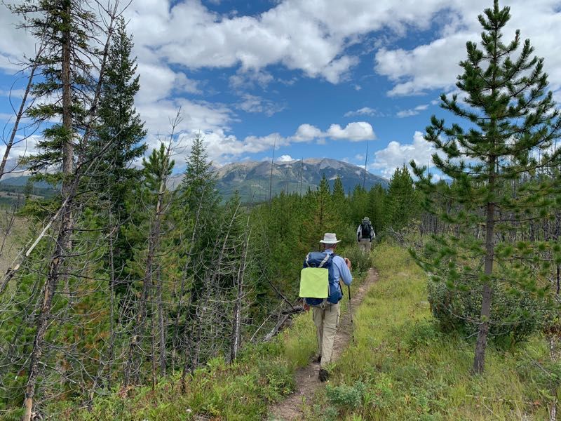
Today the morning overcast broke up a bit earlier, around 10 am. The land along the North Fork of the Sun River was much more open than what we’d been hiking through the past few days. This provided some long views and combined with the sunnier weather, made for some nice pictures.
There were lots of deer tracks along the trail in this stretch, along with a few elk prints.
We had two more fords today: one at Glen Creek (where a partially submerged log helped us get across) and another at Bear Creek. The latter was a bit of an adventure since you had to cross the creek diagonally and couldn’t see the exit from where you entered.
Just beyond Bear Creek, we found a great campsite. It had some nicely elevated logs for sitting on, and a pole lashed between two trees for hanging bear bags. Combined with very agreeable temperatures this was probably the nicest camp we’d had on this trip.
This camp was clearly used often and to further drive that home, my Dad came across a paper bag with what appeared to be somebody’s lunch: a sandwich and some candy. Something had already bitten its way through the bag and nibbled on the sandwich.
Just as we got to bed, a coyote nearby started yelping and howling.
Day 6
Since we knew it would be a two-hour drive from the trailhead to a Great Falls after we finished hiking, we decided to get up early today. We were up by 5:30. It was chilly this morning, but for the first time since the second day of our hike we woke up to blue skies. We set out in the crisp morning air at around 7:00, crossing Goat Creek on a log (probably not intended as a bridge, but it served well enough).
For most of the morning, we were hiking through a burned area, giving the sunny morning a chance to warm us up a bit. Eventually, we reached Pretty Prairie, site of a patrol cabin and a disused airstrip. South of Pretty Prairie there was another opportunity to save some distance by fording the river twice. Again, we declined and stayed on the west side of the Sun River.
We came across a big pile of fairly fresh bear scat in the middle of the trail. This was the first unambiguous sign of recent bear activity we’d seen on this hike. Soon after I noticed depressions in the ground where sizable rocks had recently been turned over. Combined with the scat, I figured this was a bear looking for grubs and insects.
We hadn’t seen any huckleberries since we dropped down to a lower elevation on the fourth day. Today, however, we did run across some raspberry bushes soon after spotting the bear scat. We partook of a bunch of berries while keeping an eye out for any hungry bears.